
A Watershed Activity for Pond and Lake Owners
Introduction
|
Terms to know:
Why you should know your watershed Lakes and ponds are directly impacted by point-source pollution coming from concentrated pollutant sources like tile drainage and industrial outlets. They are also impacted by non-point pollution that comes from the surrounding landscape. Non-point pollution is created when rainfall, or snowmelt runs over or through the ground and picks up contaminants, depositing them into streams, lakes, rivers, or groundwater. Land cover The type and amount of pollution washed into the water body depends on land cover, slope, rainfall intensity, and rainfall duration within the boundaries of the watershed. Land that has been developed and covered with impervious surfaces sheds stormwater quickly into our storm drains and water bodies like lakes and rivers, with very little infiltration of water into the soil. How pollution impacts your lake or pond Due to excess nutrients like nitrogen and phosphorous from point and non-point sources, many rural and urban small ponds and lakes across Iowa and the region have eutrophic conditions with high levels of nutrients and low levels of oxygen. This is why we see algal blooms and why many lakes aren’t safe for drinking or recreation. Why lakes and ponds are important Healthy lakes are important because they intercept pollution from their watershed and have the potential to improve water quality downstream. They also provide valuable habitat, and are the largest global source of freshwater the icecaps. |
Watershed mapping activity
|
Introduction
The type and amount of pollution washed into a lake or pond depends largely on land cover, topography, rainfall intensity, and rainfall duration within the boundaries of the watershed. This activity is a starting point for thinking about land use impacts on pond and lake health. It doesn’t explain the specific calculations for storm water volume, erosion, or pollutant concentrations. However, knowing the extent of your watershed, the land cover, and potential pollutants associated with various land covers will help you identify the pond health/water quality improvement method that is best for your water body. Summarized steps (1) The first step to this activity is locating your pond or lake of interest using online mapping tools. Next, (2 & 3) you will print three different kinds of maps containing different information about your selected location. (4) Then you will mark the flow of water across the land, (5) draw the boundaries of your watershed, and (6) identify the land cover types and possible pollutants present in your pond or lake. (7) After completing this activity, you may use our list of resources to find more information about water quality monitoring and management, and ways to integrate water quality enhancement practices into your landscape. |
|
Steps
1) Locate your pond or lake
|
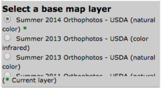
|
|
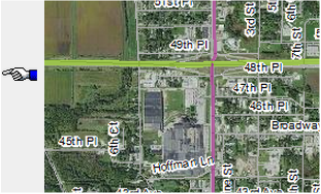
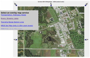
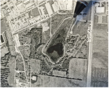
2) Map types needed
Using a few different kinds of maps of your watershed, all at the same scale, will help you understand the flow of water across the landscape. You are going to print out three maps.
|
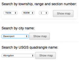
Hillshade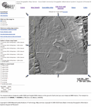
Topo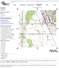
Orthophoto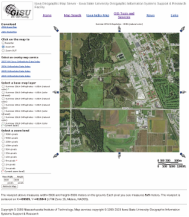
|
|
3) How to print maps
|
|
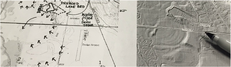
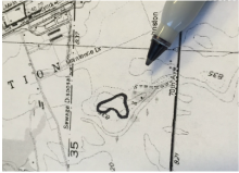
4) Mark the flow of water across the landscape
|
|
|
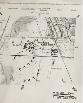
5) Draw watershed boundaries
|
|
|
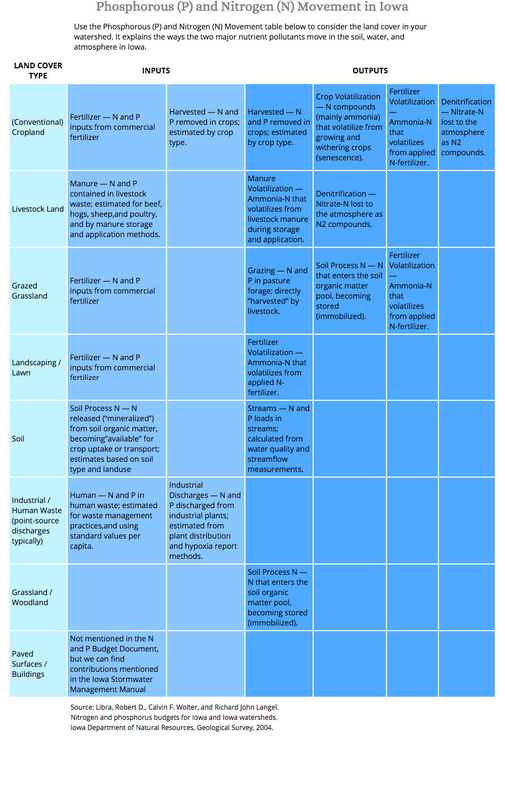
6) Identify land cover types and potential pollutants
7) Develop a water quality improvement strategy There are many resources available to pond/lake owners who would like to improve water clarity, reduce nutrient levels, algae, or invasive plants, and improve habitat. Vegetated Floating Islands (VFIs) are a relatively new, exciting option for improving water quality and adding habitat in a small lake or pond. They are especially useful when there are limits to altering the land use surrounding the water body. Learn more about VFIs here. How does this example apply to your lake or pond? Even though the lake in this example isn’t used for primary contact recreation, the steps shown above can be applied to a recreational lake to understand how to delineate flow of water within the watershed of your lake and think about the impacts of the various land use types on water quality in the lake. |
Table
|
